
 Connect with a Manager
by Tiffany Wagner
How to Plan Your Canoe Vacations
Planning a canoeing trip? Connect with nature on your vacation, where to go and what to plan, what gear you'll need, and what your expectations…
 BOOK DIRECT
Choctawhatchee Bay, Santa Rosa Sound, Santa Rosa Island, and Okaloosa Island form an interconnected coastal system that defines the geography of Florida’s Emerald Coast. Together, they create a layered waterfront landscape of protected bays, calm sounds, and Gulf-front beaches that shape the character of Fort Walton Beach and the surrounding communities.
Choctawhatchee Bay is the largest body of water in the system. Stretching roughly 27 miles long, this shallow estuarine bay collects freshwater from the Choctawhatchee River and blends it with saltwater flowing in from the Gulf of Mexico through East Pass near Destin. The bay’s wide, open waters support boating, fishing, and waterfront parks, while also serving as an important nursery habitat for marine life. It forms the northern boundary of the coastal barrier island system.
Just south of the bay lies Santa Rosa Sound, a long and narrow protected waterway that runs between the mainland and the barrier island. The Sound functions like a calm lagoon, sheltered from Gulf surf by the island itself. Because of its protected waters, it has become a hub for paddleboarding, kayaking, jet ski rentals, dolphin cruises, and family-friendly swimming areas. It also acts as a transitional waterway, connecting portions of the bay system with passes that eventually lead into the Gulf.
Separating the Sound from the Gulf of Mexico is Santa Rosa Island, a slender barrier island stretching west toward Pensacola and east toward Destin. Okaloosa Island is the developed central portion of Santa Rosa Island located directly across from Fort Walton Beach. On its north side lies the calm waters of Santa Rosa Sound; on its south side, the bright emerald waters and white quartz sands of the Gulf. This unique positioning allows visitors to experience both tranquil inland waters and open Gulf beaches within minutes of each other.
Together, these waterways and barrier islands form a dynamic coastal network. Freshwater flows into Choctawhatchee Bay, tides circulate through Santa Rosa Sound, and both eventually connect to the Gulf through Destin’s East Pass. The result is a diverse coastal environment that supports recreation, marine ecosystems, boating culture, and the scenic beauty that makes the Emerald Coast so distinctive.
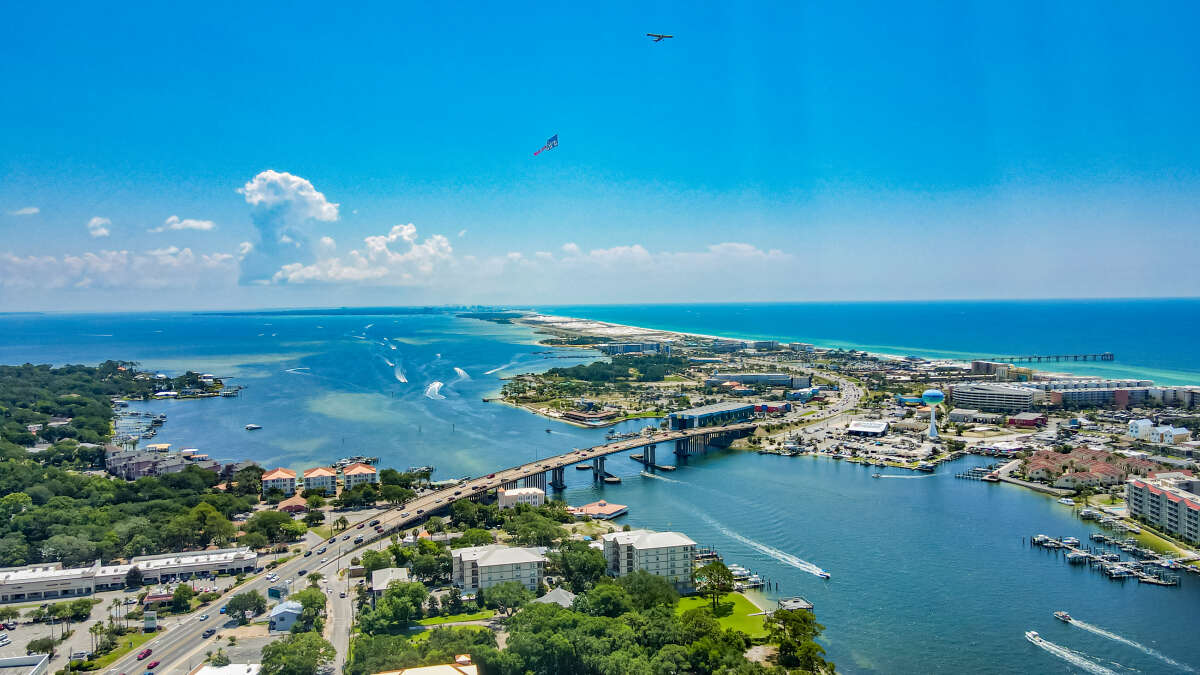
Fort Walton Beach sits on the southern shore of Choctawhatchee Bay, a large, shallow estuarine bay that stretches roughly 27 miles long and 3–6 miles wide. The bay connects to the Gulf of Mexico through East Pass in nearby Destin.
What Makes the Bay Unique
Unlike the open Gulf, the bay is sheltered from heavy surf. This makes it ideal for:
Because the waters are generally calmer, the bay is especially popular with families and recreational boaters.
Choctawhatchee Bay is an estuary, meaning freshwater from rivers (like the Choctawhatchee River) mixes with saltwater from the Gulf. This creates a nutrient-rich habitat that supports:
It’s considered one of Northwest Florida’s prime fishing and marine environments.
Several public spaces in Fort Walton Beach sit directly on the bay, including:
Fort Walton Beach offers access to two distinct waterfront experiences:
Many visitors stay in Fort Walton Beach proper for bay access and quick drives to Gulf beaches.
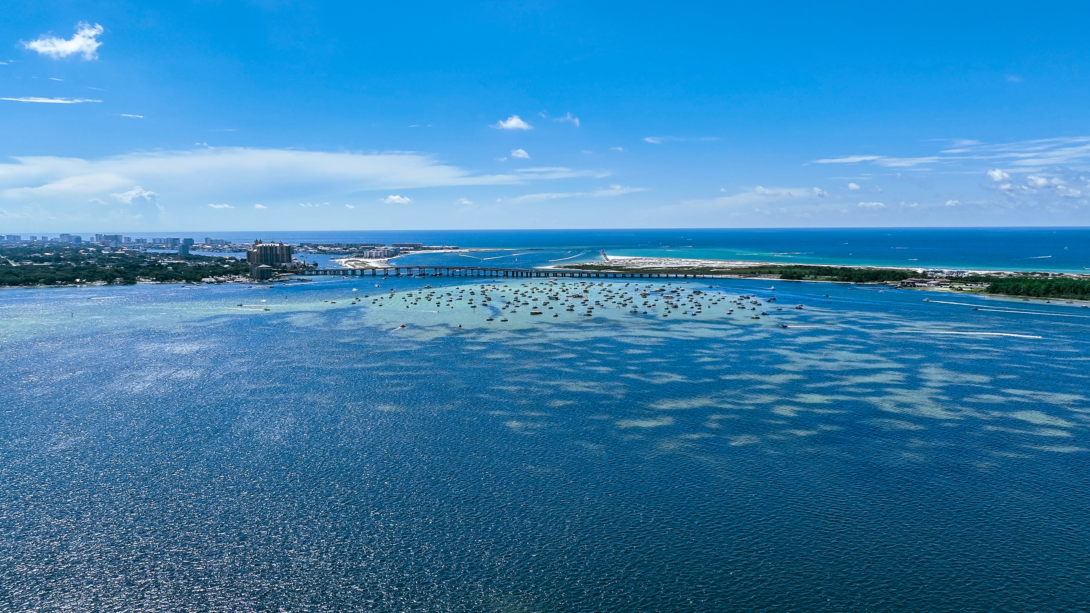
The bay also provides boating access to Crab Island, a famous submerged sandbar near Destin that becomes a social gathering spot during warm months. Most boats accessing Crab Island travel through Choctawhatchee Bay before entering East Pass.
Choctawhatchee Bay shapes the city’s identity. It provides:
The bay gives Fort Walton Beach a calmer, more residential coastal feel while still offering easy access to the dramatic beaches of the Emerald Coast.
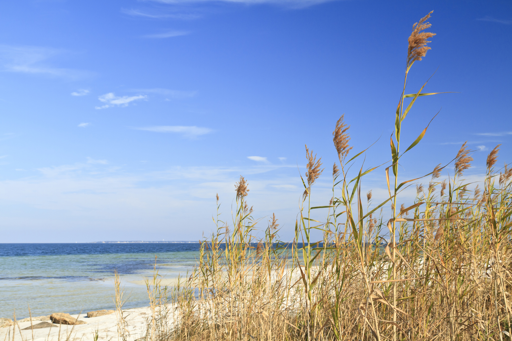
Santa Rosa Sound is the protected body of water that runs between the mainland (including Fort Walton Beach) and Santa Rosa Island, where Okaloosa Island’s Gulf beaches are located. It’s often confused with Choctawhatchee Bay, but they’re distinct waterways connected by channels and passes.
Santa Rosa Sound connects eastward toward Choctawhatchee Bay.
Water eventually flows through East Pass in Destin into the Gulf of Mexico.
The Sound is more lagoon-like and elongated, while the Bay is wider and more open.
Together, the Sound and Bay create a protected inland boating system that stretches for miles along the Emerald Coast.
Santa Rosa Sound is a long, narrow lagoon-like waterway stretching west toward Pensacola and east toward Destin. It sits directly north of the Gulf-facing beaches on Okaloosa Island and south of Fort Walton Beach.
Think of it as:
Mainland (Fort Walton Beach)
Santa Rosa Sound (calm water)
Okaloosa Island
Gulf of Mexico (open water)
Because it’s protected by the barrier island, Santa Rosa Sound has:
Little to no surf
Shallow areas perfect for wading
Warmer water temperatures than the Gulf
This makes it ideal for:
Families with small children
Paddleboarding
Kayaking
Pontoon boating
Beginner boaters
Much of the area’s:
Jet ski rentals
Parasailing launches
Pontoon rentals
Dolphin cruises
operate from Santa Rosa Sound due to its safer launching conditions.
Like Choctawhatchee Bay, the Sound is part of a larger estuarine system. You’ll commonly see:
Bottlenose dolphins
Rays
Blue crabs
Seagrass beds supporting fish nurseries
Ospreys and pelicans
It’s an important ecological zone for juvenile fish and marine habitat.
Popular access spots along Santa Rosa Sound include:
Okaloosa Island (Sound side parks and boat launches)
Liza Jackson Park (mainland access and boat ramps)
Fort Walton Beach Landing Park (downtown bay/Sound access area)
Many vacation rentals on the “Sound side” offer private docks or shallow water access.
One of the biggest draws of Santa Rosa Sound is sunset viewing. Because Fort Walton Beach faces south toward the Sound, many waterfront homes and parks enjoy spectacular sunset views over calm water often smoother and more reflective than the Gulf side.